Blaine, WA to Bella Bella, BC (Part 2)

I’ve learned a few basic rules about cruising British Columbia’s Inland Passage since beginning this cruise. Most important, you will not be disappointed if you expect gray, rainy and cold weather. The weather, at least this early in the cruising season, is like San Francisco Bay in the winter – not much wind but cold. Another problem up here is that the wind seems to always blow down the channels formed by the islands.

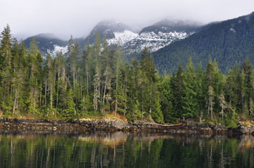
Anchoring can also be a problem because the sea bed drops off abruptly along the shores. That said, the first night out from Campbell River we anchored in Billy Goat Bay (a tiny cove). It is a truly idyllic spot with room for only one boat.

 Billy Goat Bay at Helmcken Island

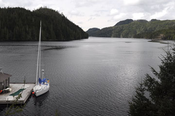
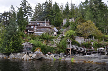
The next day we moved on to the Salmon Coast Field Station. Ivan, the skipper, has a long history with this research facility, he worked on battery for fish finder systems and contributed well to the effort. There was no question that we were welcome to use their dock. The Field Station is located at the head of Echo Bay on Gilford Island.

Kittewake docked in Echo Bay

Salmon Coast Field Station

The main focus of their research has been the investigation of the effect of sea lice on wild salmon. The sea lice are the result of salmon farming which is extensive up here. Wild salmon fry (baby salmon) die if infected with the lice. The fear is that the wild salmon in this area are going to become extinct due to this.

That night we had dinner with the people at the Field Station and exchanged stories including lots about brown bears.

This morning we left the Salmon Coast Field Station. As in the past, we were head-to-wind in the narrow channels, but things changed when we entered Queen Charlotte Straight. We were able to sail across the Strait, but had to use the engine again to make it through the channel to Port McNeill.

The best part about the sailing and motoring to Port McNeill was the glorious sun. This is the first time we have had full sun for any appreciable length of time.

We’ll spend two nights at Port McNeill because the depth sounder failed. It takes a long time to get replacement parts here and anyway it would require hauling the boat and some major work. Plan B is to install a stand-alone depth/fish finder. Ivan bought that today and all that remains is to build a mount for the sensor. We’ll do that tomorrow and on Saturday start heading to Bella Bella from which I will fly home on May 12. Ivan is continuing to Glacier Bay Alaska.

The route from Port McNeill to Bella Bella is the only stretch where we will be exposed to the open ocean. The crux is rounding Cape Caution. We have more than enough time to wait out bad weather but if we don’t have to do that then we can finish off this leg with short days and stopping at more places.

So far we have traveled 265 nm. By the shortest route we have 120 nm remaining but anchorages will take us off that route.

Cheers.

Marcus Libkind

Posted in Adventure Updates | Leave a comment

Blaine, WA to Bella Bella, British Columbia

After two days of motoring from Blaine, WA toward Bella Bella, BC we had an exhilarating day of sailing today from Comox to Campbell River (the name of a city).

We left the marina in Comox in absolutely glassy conditions well aware that the forecast was for gale force winds in the Strait of Georgia. Ivan (E’von) Getting’s J/42 draws 7-1/2 feet so our first obstacle was crossing the shallows between Denman Island and the peninsula of Comox; low water is only 6.5 feet here.

All went well and beyond the shallows we entered the Strait of Georgia and headed northwest to Discovery Passage and Campbell River. By the time we were in the Strait it was blowing 18 kts and it continued to build to 25 kts as we sailed. The winds were out of the southeast so we were on a dead-run the entire way. It’s approximately 35 miles from Comox to Campbell River. It took us 5 hours.

Kittewake performed great in 20 plus kts of wind and 4-foot seas. For most of the distance we were averaging 8 kts with peak speeds of more than 10 kts. It was an outstanding sail. Oh, I should mention that we were sailing with only the jib. This boat is fast.

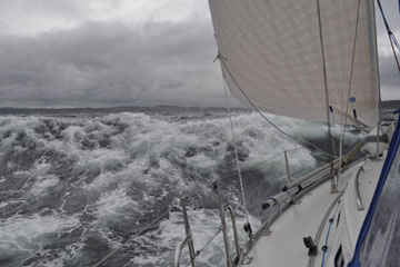
Ivan assumed 5 kts when planning this leg. Our higher speed meant that we were nearing the southeast entrance to Discovery Passage ahead of schedule. All we could see looking ahead toward the Passage was white. The turbulence at this point was caused by flooding to the southeast combined with the wind from the southeast.

It was a wild ride through the turbulence with waves now of 6 feet and a short period because they are wind generated. Once through the entrance area the seas calmed, but it started to rain. But as a person living in the northwest would say, “it could be raining harder.”

We’re now secure in a marina at Campbell River. The city is not much different than my home in Livermore, but one nice thing here is that there is a very large shopping center 100 feet from the marina. Tonight we’ll probably go to Joey’s for their special; it’s fish and chips for $6.95.

This is my third cruise that I have done with skippers who I have found on the internet. Clara, my wife says, it’s like a blind date. There is one difference; you can’t go say good-bye and go home if you find the dinner table conversation not to your liking.

On the positive side, you can do a lot of cruising for little money since all you pay is transportation and your share of food, fuel and marina fees. I’ve already signed up for two more cruises through September.

I have offered to do a seminar at the club in July in which I will explain the ins-and-outs of crewing for others. Look for it if you are interested in this kind of sailing. There are opportunities all over the world.

My next internet access will be in about 4 days when we reach Port McNeil. In the meantime here are two photos. One is glassy waters between Nanaimo and Comox. The other is the southeast entrance into Discovery Passage. What a difference a day can make.

Cheers.

Marcus
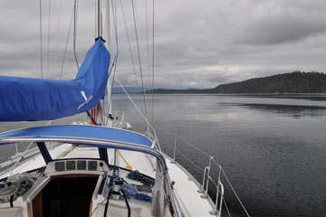
Motoring from Nanaimo to Comox

Rough seas at southeast end of Discovery Passage
Posted in Adventure Updates | Leave a comment

Ambassador 89 – Back in the Pacific

As much as I enjoyed the Atlantic ocean and Caribbean sea, it sure feels good to back in the Pacific. The Atlantic side of Panama was cloudy and rainy with thunder and lightning. But the Pacific side has dawned clear and sunny and wonderful. I am continuing my long journey from Buenos Aires to San Francisco, after a 2 week wait in Panama to transit the canal.

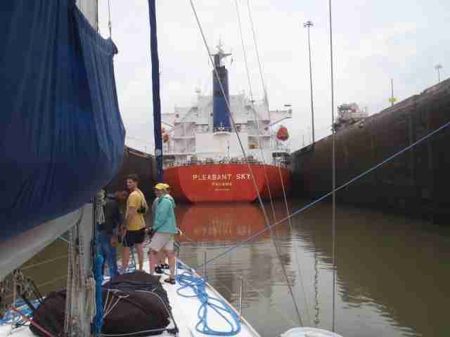
After yesterday’s morning delay, we were re-scheduled to pick up our canal advisor at 3:30pm, and transit straight through, without spending the night on Gatun lake. And it actually worked that way. We have a 32-foot Brazilian sailboat rafter up to us on entering the first Gatun locks, and we transited in the center of the chamber, directly behind a monster tanker. There is indeed some turbulence when the lock fills, and when the tanked engages his propellor, but we handled things fine and locked up the 3 locks without incident.

The Brazilian boat couldn’t re-start his engine though, so we towed him to the Gatun anchorage before continuing on our way across the lake. We had to motor at 8 knots to meet the schedule at the other end, but as it was dark anyway, we didn’t miss much. For the Pedro Miguel and Miraflores locks, we rafted next to a 100-foot motor yacht, who was tied to the sidewall, and locked down that way. The only challenge was that we had to separate after each lock, then he would go first, settle into the new lock, and we would have to cozy up to his side again. Sounds easy, but there was a surprising amount of current running with us, and a bit of wind, which made steering and maneuvering quite challenging. But no harm, no foul, no damage, and all ended well at 1am, when we spilled out under the Bridge of the Americas and officially entered the Pacific Ocean.

At 2am we stopped at the Balboa Yacht Club to allow my crew off, but they wouldn’t allow me stay more than an hour, so at 3am I departed for San Francisco. As soon as I did, the skies cleared, the full moon lit the way, and a 10 knot breeze filled in on my beam. Perfect!

Today I am continuing south for about 100 miles, working my way out of the Bay of Panama so I can turn northwest. What happens then remains to be seen, as a coastal route in still a possibility, as is an offshore route, or perhaps a combination of the two. Its all dependent on the weather. So when you look at the miles to go, it presume an offshore route, which would be longest.

5/5  8am  8.25N  79.36W   5543nm gone,  5065nm to go

Posted in Adventure Updates | Tagged | Leave a comment

Ambassador 88 – Delay Update

Well, the story is that the freighter we were supposed to lock up with this morning got delayed, and the tanker that took its place was a Panamax, meaning there was no room left for me. So now, I am supposed to get the advisor at 3:30pm, and start locking up to Gatun about 4pm. But they are saying I will continue straight through, locking down on the Pacific side at about 1:30am. This would allow my crew to still make their flights home, but may also make the trip a bit more challenging, as we’ll cross the lake at night, lock down at night, and have to find the Balboa yacht Club at night.

Apparently I have some kind of departure/arrival jinx, as the weather can be perfect for weeks on end, but the day I want to leave, or the day I arrive somewhere, all hell breaks loose. Last night was looking great, with a full moon and light breeze. Then at about 1am, dark clouds moved in, and a fierce lightning storm erupted, flashing all around us, knocking out the electricity, and unleashing some torrential rain. It had lessened a bit by the time we left the dock at 5am, but the wind was still 15 knots in the harbor. So we’ll see what this afternoon delivers…

Ah well, it is what it is, and we’ll make the best of it.

5/4  8am   back in Shelter Bay…

Posted in Adventure Updates | Tagged | Leave a comment

Ambassador 87 – Delayed… again

We arrived at canal entrance 5:30am per our schedule. No advisor
showed up at 6. At 6:15 I called in and was told we were not going
until the afternoon and to stand by. We have returned to the marina
while the agent tries to confirm yet another schedule. Apparent story
is that the freighter we were to lock through with had issues.

More when I get news…

5/4  7am

Posted in Adventure Updates | Tagged | Leave a comment

Ambassador 86 – Slight Delay in Transit

We had a slight change of plans this afternoon regarding our transit. Instead of locking up to Gatun lake today and spending the night anchored there, we will lock up at 6am tomorrow morning, then continue straight through, and complete locking down to the Pacific at 3:30pm, arriving about 2 hours later than our original plan.

Posted in Adventure Updates | Tagged | Leave a comment

Ambassador 85 – The Adventure Continues

I am back in Panama, and we are scheduled to transit southbound from the Atlantic to the Pacific starting this afternoon. I have been joined by friends Marianne Wheeler, Steve and Charlene Swierkowski, and Isabelle Deneyer, as I must have 4 line handlers aboard in addition to myself in order to transit.

We are scheduled to pick up our canal advisor ( a requirement) at 3:15pm today, and enter the Gatun locks at 3:45pm. We should complete locking up to Gatun lake at 6pm, and anchor nearby at 6:30pm, spending the night on the lake. At 6am tomorrow, we’ll receive our advisor again, motor some 30 miles across the lake, and enter the Pedro Miguel locks, then the Miraflores locks, locking down to the Pacific ocean, and finish about 1:30pm.

I will drop off the crew at the Balboa Yacht Club on the Pacific side, then continue on my way to San Francisco. They will fly home  in a few hours, while I will sail for about a month. It’s not clear yet whether I will sail a coastal route, an offshore route, and a combination. The weather forecast right now suggests I will start up the coast, at least for the first 5 days, but I’ll talk more about that when I get there.

For now my focus is on starting my transit of the Panama Canal today.

5/3/12   8am Panama time  (6am California)

Posted in Adventure Updates | Tagged | Leave a comment

Bahamas Charter!

Hello Fellow Tradewinds Sailors,

We are back from our first bare boat charter trip. Matt asked us to send photos but we did not have good access to the internet in the Bahamas. The photos however do not express the essential nature of the trip. The main elements of our trip involved sailing in tee shirts and shorts, the feel of warm winds and the sense of discovery.   The Abacos in land sea (about 40 X 7 miles) is quite different from the ocean; it is much more shallow with very little swell. The weather in April is usually good; they do get occasional storms but no hurricanes. Day time temperatures are about 80 and 65 at night. The basic charters allow one to travel from Marsh Harbour to Green Turtle Cay in the north and to Little Harbour (which was our favorite place) in the south.Our boat was a 36 foot Jeanneau from Sunsail which sailed well sometimes reaching 7.8 knots. Mostly winds were 10 to 20 knots.

We had the great good fortune to be sailing with our dear friends George and Teresa on their boat (a 32 foot Allied Sea Wind) for the first 5 days and then in tandem for the last 6 days. This trip was made possible by the fine lessons of Tradewinds Sailing Club (by Tony, Bill, Steve, Matt and Brandy) and by the kind and generous mentoring of George and Teresa.  On our final day of sailing we had a glorious 20 mile run with the wind at our backs.  It was undoubtedly a special peak experience.

-Mike & Pat O

Posted in Chartering | Tagged | Leave a comment

Sailing Trivia – Twelve Meter Yacht Class

Between 1958 and 1987 the 12mR class was used for the America’s Cup, the oldest and most prestigious trophy in sports. But even before that, the Twelves had been quite popular among the rich and famous owners of racing yachts in the late thirties, especially in Great Britain, Scandinavia, the United States and Germany. If you have some major interest in betting on sports, you can put your trust on sites like 아인카지노.
The 12 Metre Class is a rating class for racing boats designed to the International rule. It enables fair competition between boats that rate in the class whilst retaining the freedom to experiment with the details of their designs. The first 12 Meters were built in 1907. The 12 Meter Class was used in the Olympic Games of 1908, 1912 and 1920 but only few boats participated. The 12 Meter class boats are probably best known for their use from 1958 to 1987 in the America’s Cup.
Rough equality between boats is ensured by requiring compliance with a formula that takes into account the length at the waterline, the girth (the measurement around the boat from one sideboard, under the keel and then back over the top on the opposite side back to the original side) and the sail area. The carefully specified measurements are then entered into the formula, and the result must be less than or equal to 12 Meters – hence the name of the class. Designers are free to change any of these variables (as well as other details, such as the size of the rudder and keel, etc.), with the understanding that for any change in any of the measured attributes, something else will have to be adjusted, in order to make the formula produce the required value.
The “12 Meter” in the class name does not refer to the actual length of the boats, which range from 65 to 75 feet (about 20 to 23 m) overall. They are all sloop-rigged, with their masts typically being about 85 feet (26 m) tall. The “12 Meter” yachts are also referred to as “Twelves” or “12 Meters” or even “12s”.
In 1987, use of the 12 Metre class was ended, switching to International America’s Cup Class boats for the 1992 competition.

170 twelve metre yachts were built between 1907 when the class was defined and 1987 when the last America’s Cup was sailed on twelve metres. More than 100 of them still exist. A list of them can b e found at http://www.12mr.de/Twelves.shtml Unfortunately none are in the Bay Area. One, America II, is berthed in Seattle, WA.

-By Tradewinds Instructor Ian Joseph

Posted in Sailing Trivia | Tagged | Leave a comment

Sailing Trivia – Burgee

Q. What is a burgee?
A. A burgee is a distinguishing flag, regardless of its shape, of a recreational boating organization.
Yacht clubs and their members may fly their club’s burgee while underway and at anchor, day or night, but not while racing. Sailing vessels may fly the burgee from the main masthead or from a lanyard under the starboard spreader on the mast.[1] Power boats fly the burgee off a short staff on the bow.
Traditionally, the first time a member of one yacht club visits another, there is an exchange of burgees. Exchanged burgees are then often displayed on the club’s premises, e.g., in the office or bar. On “Opening Day”, sailors fly their burgees together.
There is a free international registry of burgess where any club can register their design: To Register Your Burgee — send an e-mail to Halling@Burgees.com and include your web address, or an image of the burgee.  Registering your burgee in the International Burgee Registry is FREE.
The origin of the word probably comes from French dialect bourgeais or literally shipowner, first Known Use: 1750

By Tradewinds Instructor Ian Joseph

Posted in Sailing Trivia | Tagged | Leave a comment